|
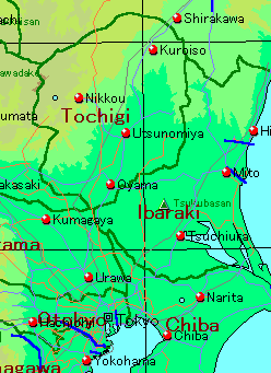
Tochigi Pref.
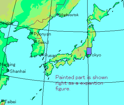
belongs to the Kanto district of Japan. And the form is an
ellipse
and the area is 6408k㎡.The seat of the prefectural office is Utsunomiya and the lacationis east
longitude 139°53′, north latitude 36°34′. Although north-
west department and also the eastern part are a mountainous area
as for the
former the high mountain such as Mt. Shirane (2578m), Mt. Takahara (1795m),
Mt. Nasu (1917m).The main peak of the other, latter are
the gradual mountain
of 300~500m height above sea level with Mt. Yamizo
(1022m). From the center
to the south of the prefecture is plain or hill of about 12~200m above sea level.
Although there are not big lakes and marshes, Lake Chuuzenji
(11.8k ㎡, 1269 m
above sea level) is forming the excellent view of Nikko with Mt.
Nantai(2484m).
And the Watarase retarding basin where adjusts the quantity of
waterof Wata-
rase River in the most south. The climate of Tochigi Pref. is a
typical Pacific side
of Japan style climate and the snow in the winter is almost
nonexistent except for
a part of area of northwest department. The year average temperature of Utsunomiya is 13.0℃ and the precipitation is 1383 mm for a year. The isotherm of the year
average temperature of 13 ℃ that are made with the boundary of the warm-temperate zone and cool-temperate zone are passing
the center of the prefecture.
The vegetation
of Tochigi Pref. reaches to the alpine zone from warm-temperate
zone.The forest of Castanopsis cuspidata var. Sieboldii where represents the warm-temperate zone is remaining to a part of the
south of the prefecture such as Mt.Takadate(302m). The forest of Quercus serrata and the forest
of Pinus dnsiflora where most of the center and the south of about 500m or less height above
sea level prefecture are the secondary forests are distributing it.
The valley of every place is the plantation of the forest of Cryptomeria japonica.Many of the plains are a farming area and residential section etc. 500~1500m
above sea level,the forest of Fagus crenata is distributing with the point centering
aroundprefecture northwest department. The same height above sea level
there are the places which are the forest of Abies firma or the forest of Tsuga
sieboldii.about 1500~2000m abovesea level arethe subalpine zone. The area,the forest of Abies veitchii,
the forest of Tsuga diversifolia, the forests of Betula ermanii etc. are distributing. The areas of the height abovesea level of about
2000m or more is alpine zone and forest of Pinus
pumila and gassland are distributing. The spiecies number of the vascular plant
thatis recorded in
Tochigi Pref. is 2569 (Tochigi Pref. plant table 1968) that even includes
subspecies, variety, and form.This number is about half of the whole Japan.
The record spiecies number is increasing with recent research.
Pinguicula ramosa(Lentibulariaceae),Anaphalissinica
var.vicosissima(Ciompositae),Iris setosa var. nasuensis(Iridaceae) are
characteristic plant in Tochigi Pref. Pinguicula ramosa is distributing it only in Nikko neighborhood to global with the plant
that was discovered in1890 in Ashio(Mt. Koshin). Anaphalis
sinica var. vicosissima distributes it in Kuriyama with the variety
of Anaphalis sinica it is few.Iris setosa var. nasuensis is produces limited toNasu and the inner perianth is bigger in comparison
with mother species. Cardamine
dentipetala(Cruciferae),Aster kantoensis(Compositae),Youngia chelidoniifolia(Compositae),Tripogon longearistatus(Gramineae),Carex hymenodo(Cyperaceae),Amitostigma
gracile(Orchidaceae),etc. are given to a precious species on distribution there
are few individual numbers whichever and the protection is necessary.
|
 2000/6/4